| dc.contributor.author | Danladi, Iliya Bauchi | |
| dc.contributor.author | Gül, Murat | |
| dc.contributor.author | Ateş, Ersin | |
| dc.date.accessioned | 2020-11-20T14:39:58Z | |
| dc.date.available | 2020-11-20T14:39:58Z | |
| dc.date.issued | 2020 | |
| dc.identifier.issn | 1814-232X | |
| dc.identifier.issn | 1814-2338 | |
| dc.identifier.uri | https://doi.org/10.2989/1814232X.2020.1727953 | |
| dc.identifier.uri | https://hdl.handle.net/20.500.12809/626 | |
| dc.description | ates, ersin/0000-0002-1956-2017; Gul, Murat/0000-0003-1555-6426 | en_US |
| dc.description | WOS: 000530941000005 | en_US |
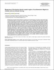
| dc.description.abstract | Despite threats emanating from the influence of climate and non-climate forcing on the barrier island coastal region of southwestern Nigeria, the extent of the coastal erosion is poorly understood. We report evidence of coastal erosion and sediment accumulation in the region over a 34-year period (1973-2017), using Landsat imagery at intervals of approximately six years. Landsat image corrections and various water-extraction algorithms were used to systematically delineate coastal erosion and accumulation in the area. The region was subdivided into western and eastern subregions separated by Lagos Harbour. In the west, erosion took place during the periods 1973-1979, 1979-1984, 1990-1999 and 2005-2011, whereas in the east, erosion occurred during 1973-1979, 1990-1999 and 1999-2005. Coastal sediment accumulation occurred in the east during 1979-1984, 1984-1990, 2005-2011 and 2011-2017, whereas gains in the west occurred during 1984-1990, 1999-2005 and 2011-2017. The study revealed substantial net erosion of 1 228.1 ha in the region as a whole, over the full period. Sediment accumulation accompanying the coastal erosion appears to be linked to longshore drift. Erosion between 1973 and 2011 was probably attributable to climate change (storms and tidal conditions), longshore drift, the inflow and outflow of water at Lagos Harbour, coastal morphology and, possibly, human impacts. However, the coastal changes between 2011 and 2017 were more obviously associated with human activities, such as development of the Eko Atlantic construction project. Coastal surveillance, together with the use of environmentally sensitive protective measures, could possibly help to reduce coastal erosion in the region. Careful coastal management practices, including artificial nourishing and the installation of resilient structures (e.g. seawalls), should be undertaken to protect human settlements that are already at risk from sea-level rise. | en_US |
| dc.item-language.iso | eng | en_US |
| dc.publisher | Natl Inquiry Services Centre Pty Ltd | en_US |
| dc.item-rights | info:eu-repo/semantics/openAccess | en_US |
| dc.subject | Coastal Erosion | en_US |
| dc.subject | Eko Atlantic Project | en_US |
| dc.subject | Gulf of Guinea | en_US |
| dc.subject | Human Impacts | en_US |
| dc.subject | Landsat Imagery | en_US |
| dc.subject | Longshore Drift | en_US |
| dc.subject | Sediment Accumulation | en_US |
| dc.subject | Water Extraction Indices | en_US |
| dc.title | Response of the barrier island coastal region of southwestern Nigeria to climate and non-climate forcing | en_US |
| dc.item-type | article | en_US |
| dc.contributor.department | MÜ, Mühendislik Fakültesi, Jeoloji Mühendisliği Bölümü | en_US |
| dc.contributor.institutionauthor | Danladi, Iliya Bauchi | |
| dc.contributor.institutionauthor | Gül, Murat | |
| dc.identifier.doi | 10.2989/1814232X.2020.1727953 | |
| dc.identifier.volume | 42 | en_US |
| dc.identifier.issue | 1 | en_US |
| dc.identifier.startpage | 43 | en_US |
| dc.identifier.endpage | 51 | en_US |
| dc.relation.journal | African Journal of Marine Science | en_US |
| dc.relation.publicationcategory | Makale - Uluslararası Hakemli Dergi - Kurum Öğretim Elemanı | en_US |


